MichaelMassie.com/projects
Project Journal
Natural Disasters Over Address Book Map
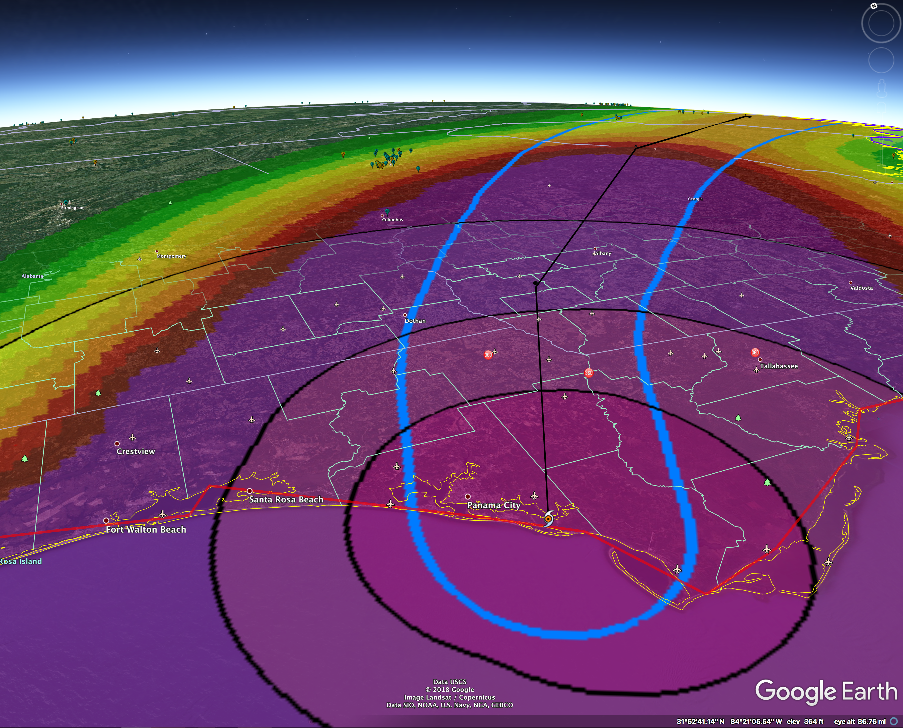
I recently took an adaptation from a work R&D prototype and gave it a personal spin. Since Hurricane Harvey and then the LA Camp Fire, I’ve wanted a way to look at a map and see exactly where these natural disasters are and then overlay my network of friends and family as pins on that map. With friends on both coasts, I dumped my Address Book into Google Earth and then loaded all natural disaster data - from hurricanes, earthquakes, to wild fires on NOAA, USDF, etc - to check-in to make sure friends are far from danger.
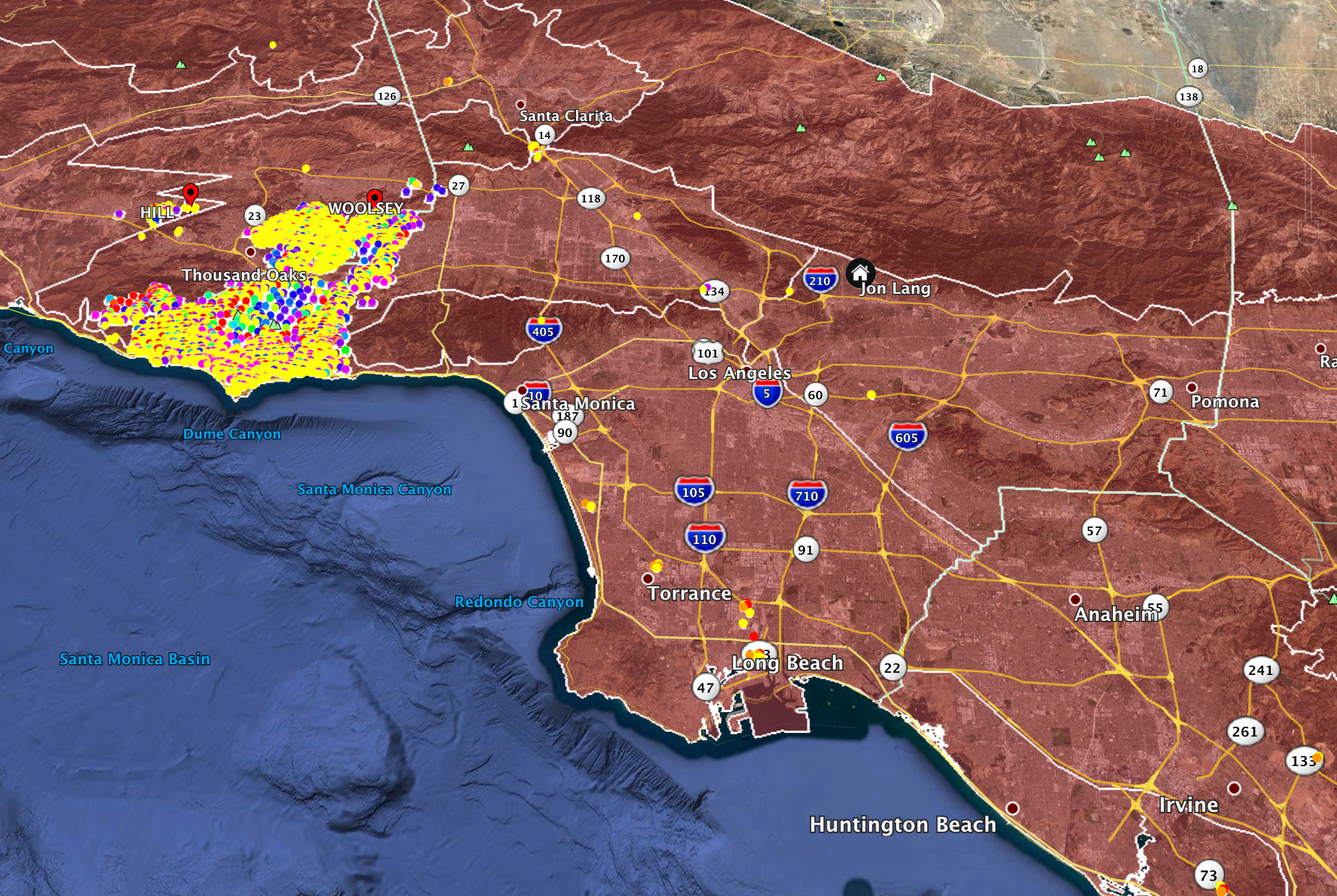
The second image (below) is the data from the Camp Fire outside of Los Angeles. Not knowing the LA area well I had legitimate concern over friends who lived in the area and an apprehension to text or call in the event they’re actually in harm’s way and not in a position for chit-chat. It’s a small picture, but you can see that my friend Jon, in Pasadena, was plenty far from the area and doing just fine. As natural disasters and the 1000 year __ are becoming prevalent, I’m thinking more serious about building a more polished implementation of this dirty demo. - Glad to see and hear you were safe, Jon!